Our Blog - Saint-Malo, France
We probably spent more time in Saint-Malo than any other town during this trip, a historic French port on the English Channel. We used it as a base to explore a few other towns and cities nearby and so we actually didn't take THAT many pictures. It was founded by the Gauls in the 1st century BC and in the 5th and 6th centuries, many Celtic Britons fleeing instability across the Channel landed here. The name is derived from Saint Malo or Maclou, an immigrant from what is now Wales. There have been a few specific points in history that includes Saint-Malo. In the 19th century, it was home to many corsairs (basically French pirates) who raided British ships in the channel, bringing the wealth back to the city. Then in World War II, the buildings inside of the walled city were almost totally destroyed by American and British bombardments as well as by a fire lasted about a week. The 12-year restoration project re-created the city buildings almost exactly as they were before.
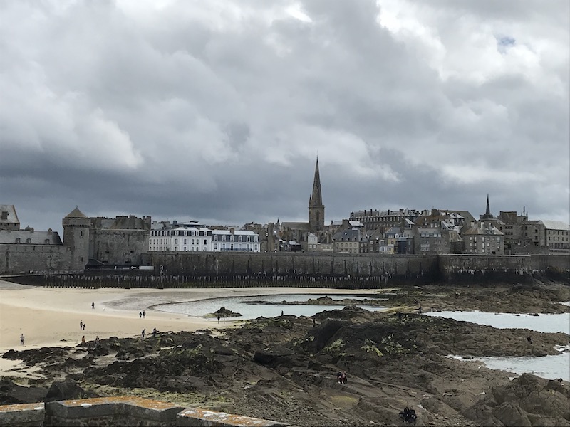
One interesting that that you will see through several pictures is the difference between high tide and low tide. The tidal range (amplitude between low and high tides) can reach 46 feet, more than double the ordinary range in the Atlantic. Caution is required at the seaside. Before venturing on the sandbanks or on the rocks at low tide, you need to know the tide times. We actually saw this first-hand as we were watching from the ramparts as the tide was coming in one evening and people were almost caught on Fort National (they ended up carrying a stroller over the heads in waist-high water).
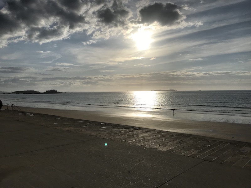
We arrived in the evening and grabbed some pictures as the sun was setting across the water as we headed for dinner.
Another set of oysters, these were just an appetizer but they were served with the top shells pulled off and then put back on (which we didn't see in Cancale, where the tops were removed totally when served).

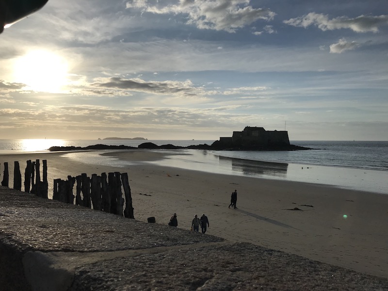
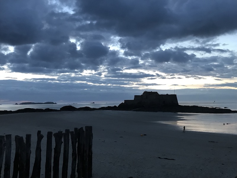
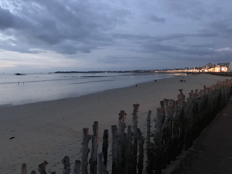
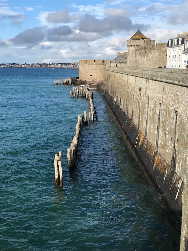
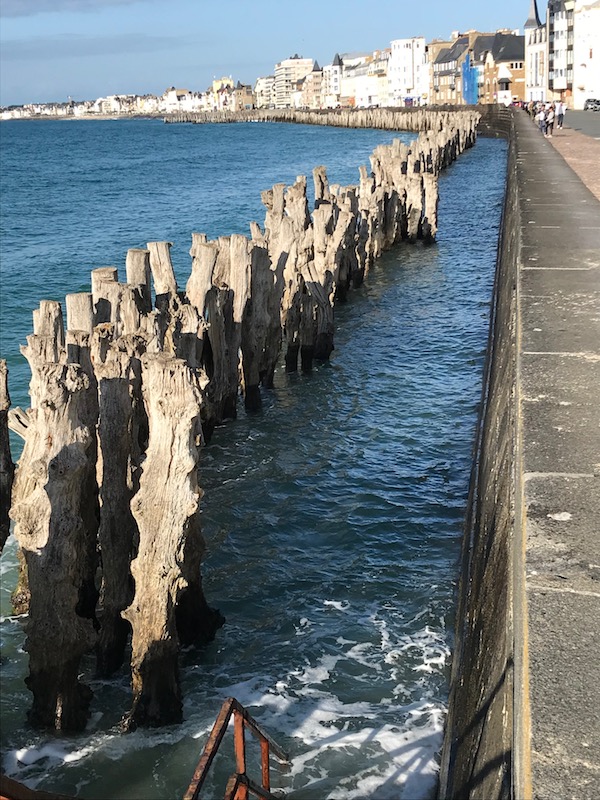
These were actually taken on the way back to the hotel after dinner. The sunset was REALLY late ... like 10:30pm! This was definitely low tide, so you can see sand all the way to Fort National. You might wonder what the tree trunks are ... those are actually a breakwater so that during high tide and storms, the waves don't hit the sea wall really hard.
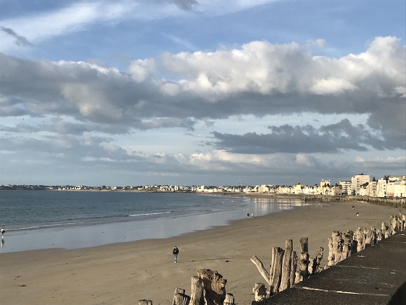
Almost the same picture the next morning, still at low tide.
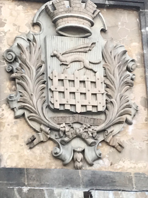
Porte Saint-Vincent, one of the main gates, has two sculpted coat of arms: the first being that of the city of Saint-Malo which is a portcullis (the gate that can be lowered to keep people out) with the ermine (the weasel-like animal) wearing a scarf. and the second being that of Brittany, which has a set of "ermine spots" (the conventional heraldic representation of the tail of the ermine/weasel with three tufts at the one end converging to a point and topped by three studs).

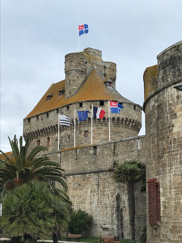
Just inside this gate is the 15th-century Château De La Duchesse Anne with its keep and watchtowers commanding an impressive view of the harbor and coastline. It has a museum now that we weren't interested in visiting, and some government offices, so only the one picture from outside of the walls.
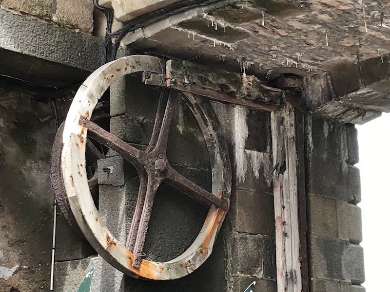
Porte Saint Thomas was opened in 1740 and you can still see the mechanisms to close the portcullis that would be used to protect the city if needed.

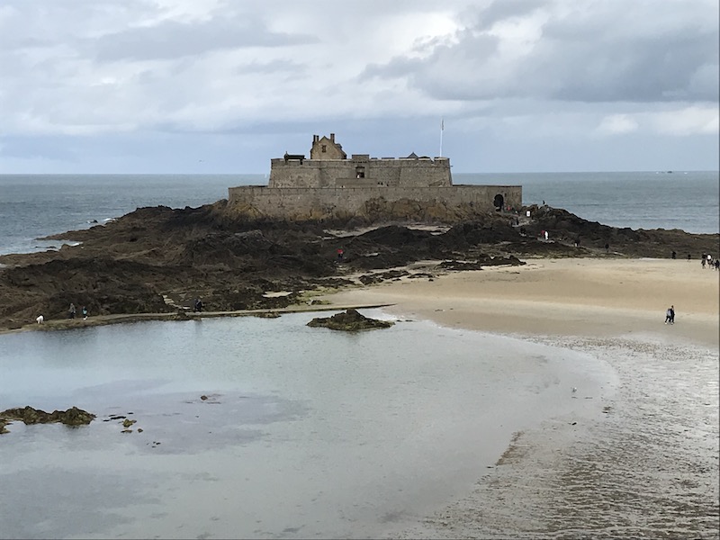
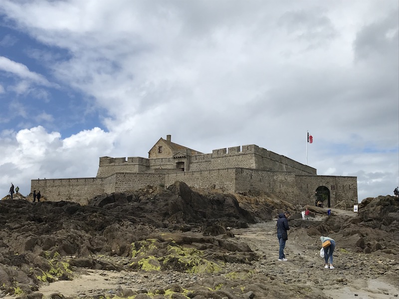
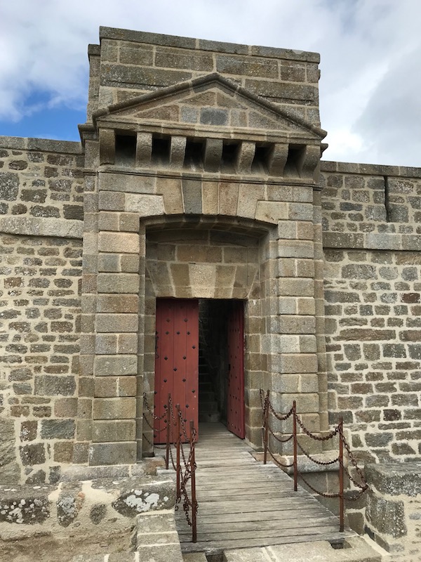
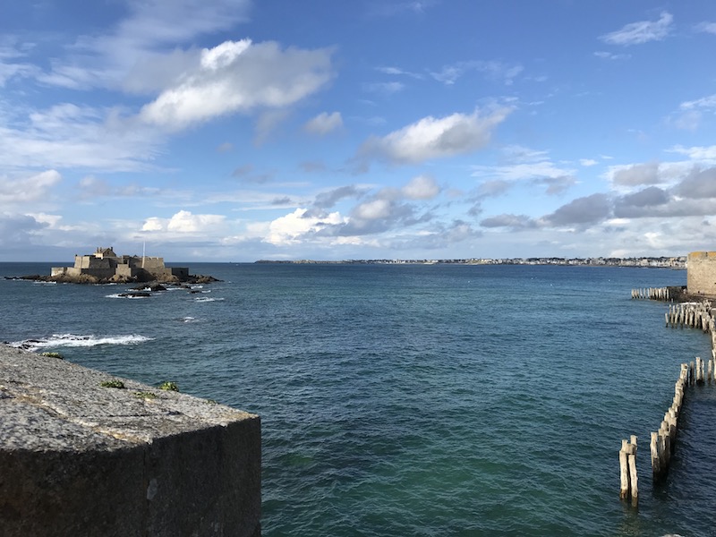
Lying offshore and accessible by causeway at low tide only, the "Bastille of Brittany" (Fort National) is a massive fortress with a dungeon constructed in 1689 and designed by Vauban, who was a famous designer of fortresses around France. The original fort was a rectangle, built of granite, with two half bastions at the south to protect the gate. A drawbridge gave access across a dry moat. Inside the fort there is a long building that contained quarters for the officer and troops, and equipment rooms. You can see how it is actually on a small island that is off the coast and, as you saw in prior pictures, it is encircled by water at high tide.
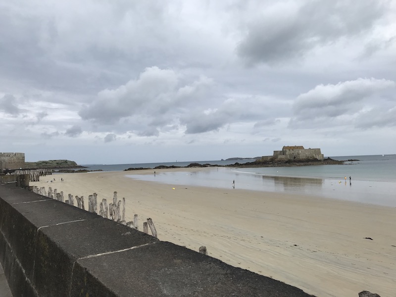
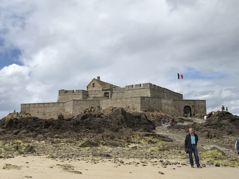
Views to the city from the Fort National ... see how much beach is visible when it is low tide??
We took a few minutes and walked around, although what is there was less interesting than what you could see from the top, including the city and a couple of the other islands. One of the islands, called Grand Bé, is where French writer François-René de Chateaubriand is buried. It, as well as the Petit Bé, can also only be reached during low tide.
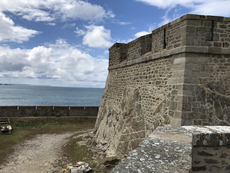
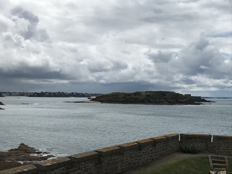
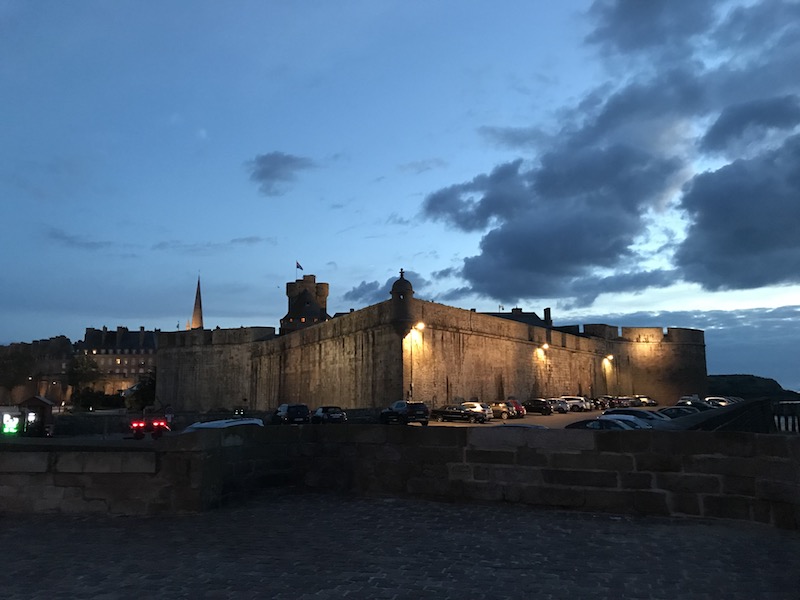
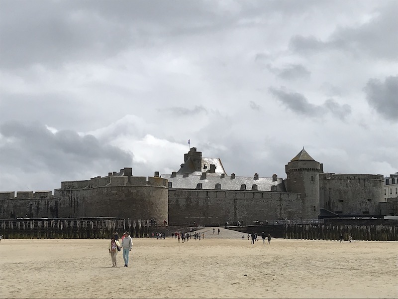
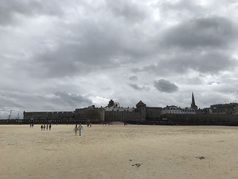
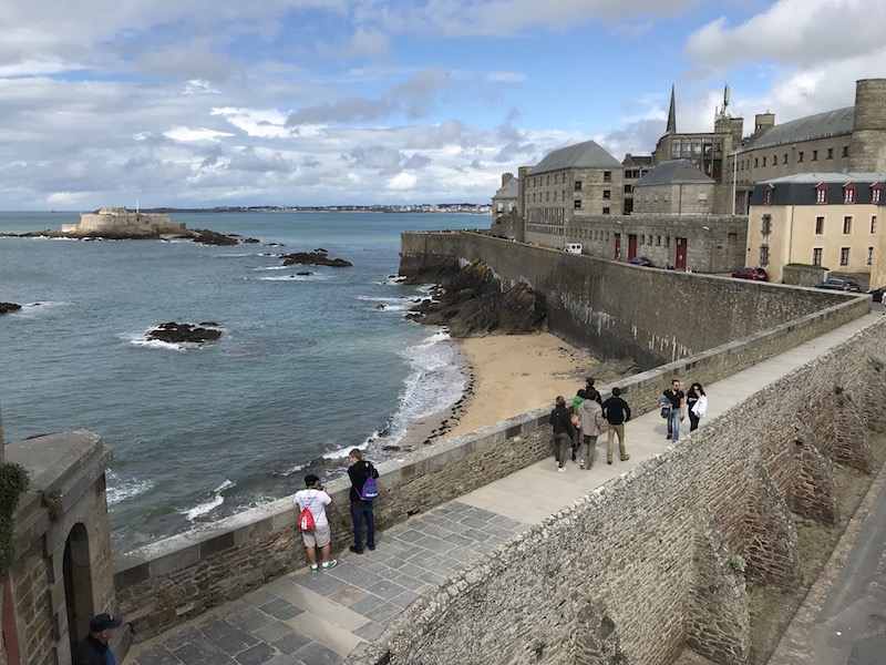
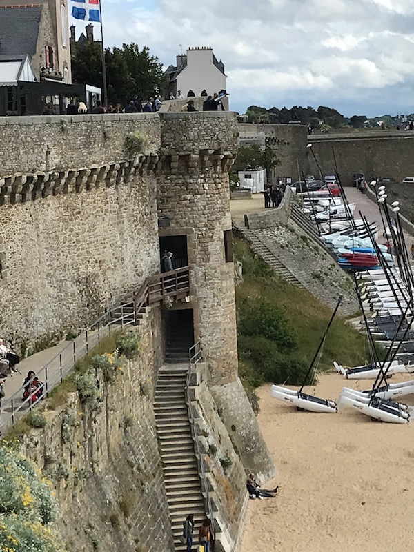
We took a few hours and did the "Rampart walk", which goes around the entire walled Vieille Ville (the Old City, known as intra-muros or within walls) along the top of the walls, approximately 1 mile. The ramparts have withstood the pounding of the Atlantic since the 12th century and were enlarged and modified in the 18th century. Here you can see Fort National between high and low tides and it is now an island but you can still see a few of the rocks between it and the city. A bit of trivia about these fortifications: unlike the city, which was 80% destroyed during the Second World War, the ramparts did not suffer from Allied bombing in 1944.
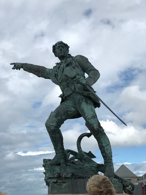
The swashbuckling corsair Robert Surcouf, a hero of many daring 18th-century raids on the British navy, eternally wags an angry finger over the waves at England.
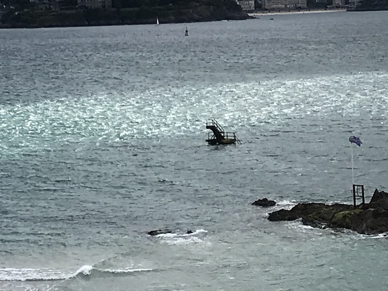
This is what you can see of the piscine de bon sejour during high tide. It is a pool that is created on the beach but it gets submerged during high tide and you can only see the diving board.
So now, high tide has arrived and you can see how the trees that were previously not even in water at all, are now 1/2 covered. And in the 3rd picture, that is Fort National again, this time, there is only water between it and the city ... nobody is walking over there to visit the Fort again until low tide.
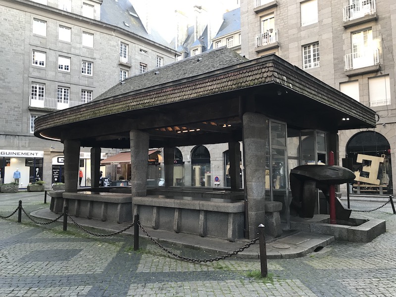
At Place de la Poisonniere (Fishmarket Square) is a covered fish market that was built in 1954
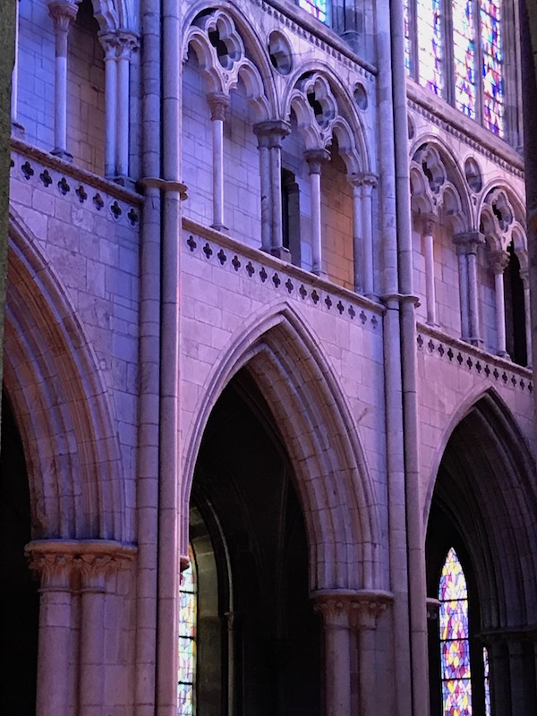
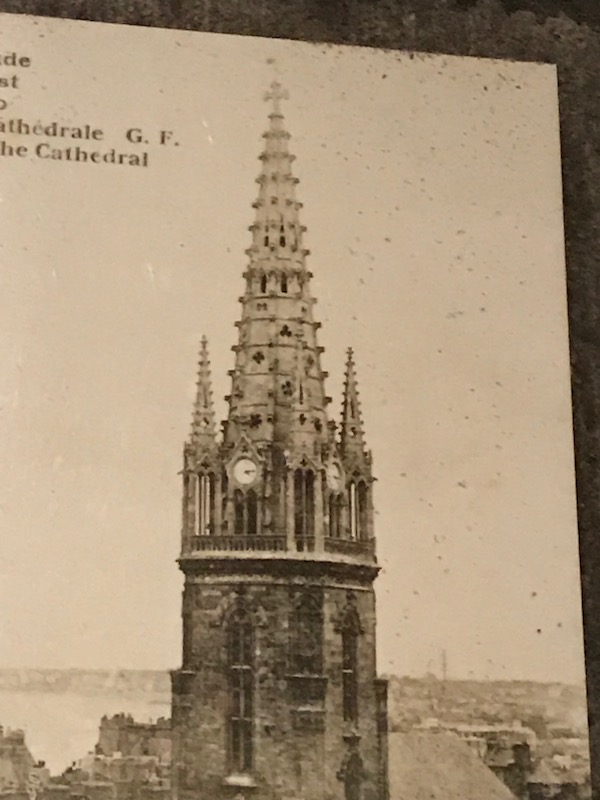
Cathédrale Saint-Vincent was originally founded in the 12th century, but updates and changes have given it a very eclectic range of architectural styles. The nave, transept, and part of the cloister are still visible from the 12th century Romanesque building. The choir was rebuilt in the 13th century. The Neo-Classical façade was added in 1773 and topped by a Neo-Gothic spire from 1860. The remains of the cloister are not actually where they originally were, but instead, they were moved here when they were found nearly under a house.
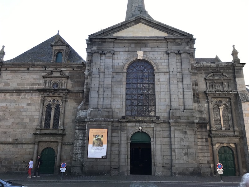

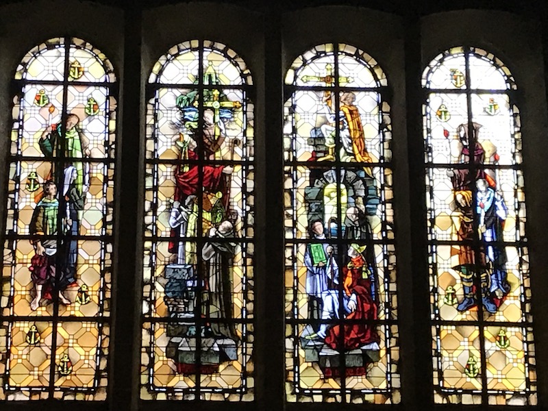
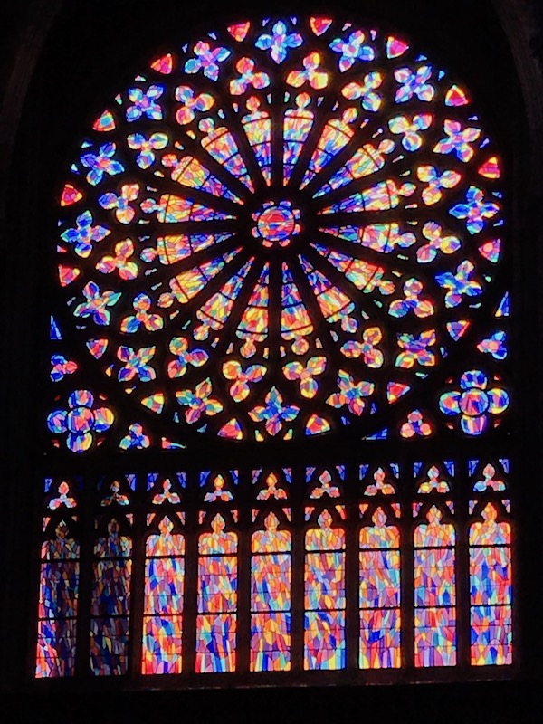
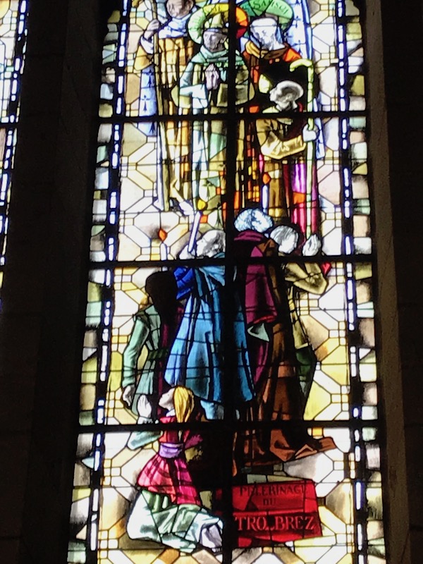
The spire was reconstructed in 1971, as it was destroyed during the 1944 bombings, and the Cathédrale reopened in 1972 with a new set of stained-glass windows, these in a very modern style.
Here you can see the clash of styles, with Gothic "pointed" arches along with the more rounded Romanesque ones.
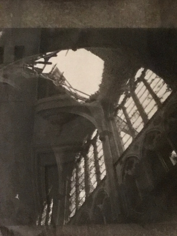
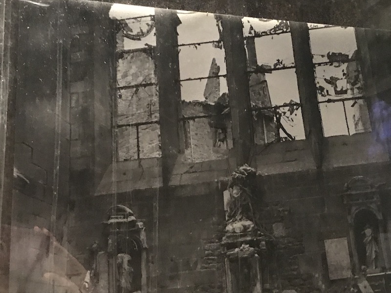
For us, the most interesting thing about this church was a display with actual pictures of what the church looked like before and after the bombings of World War II. Here we have a picture of the Neo-Gothic spire that was added in 1860 thanks to Napoléon III.
This picture shows the large hole where the spire came down through the vault of the choir, and most of the stained glass was lost.
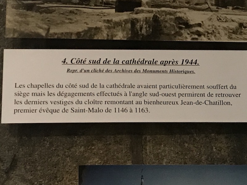
And the South side of the Cathédrale, pretty much destroyed.
Lastly, the Chapelle of the Virgin after the bombings.
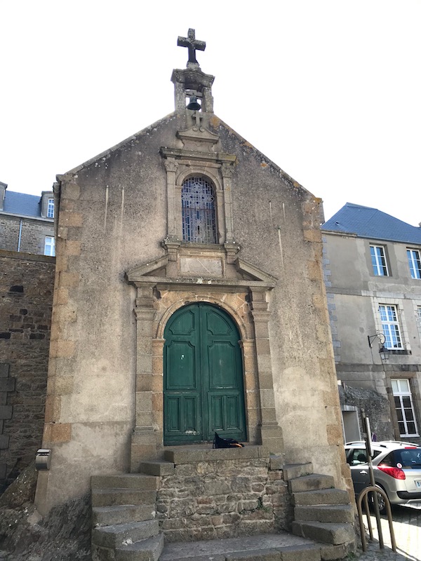
This small chapel, Chapelle Saint-Aaron, was built on the highest point of the city and consecrated in 1621. It is named for the first hermit who arrived here in the 6th century. Legend has it that this hermit welcomed Saint-Malo when he arrived from what is now England.
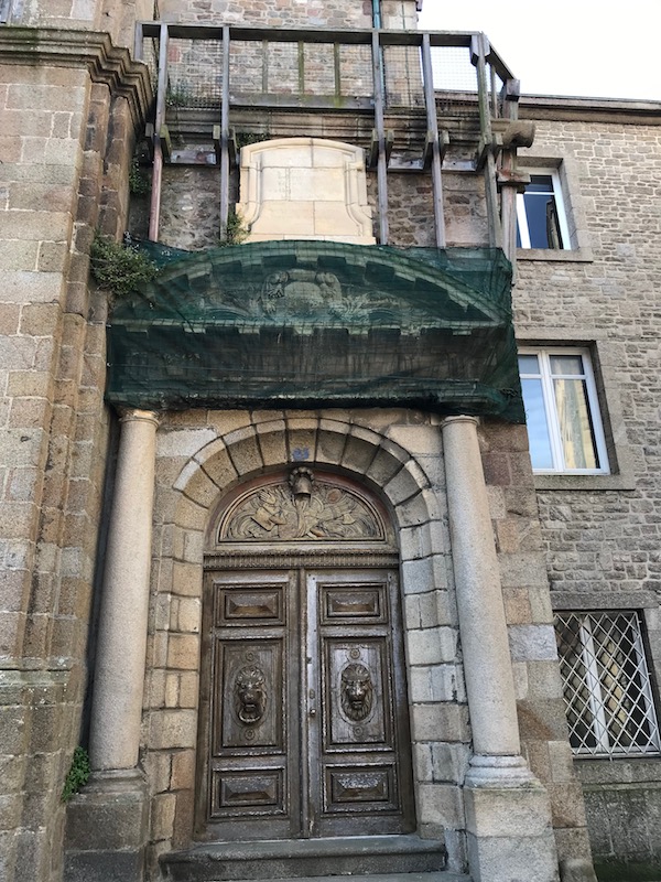
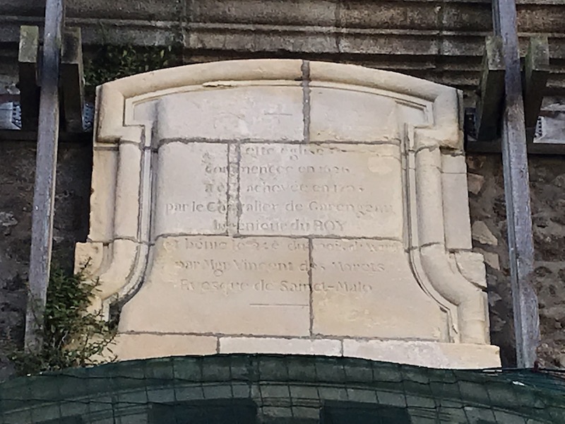
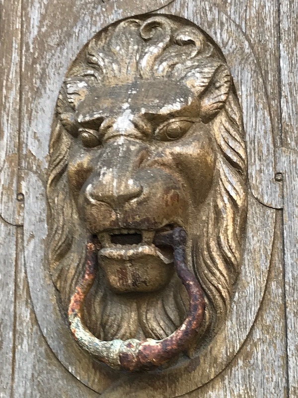
Some of the houses on Rue Saint-Benoist were actually part of an original monastery that was established here in 1669. One house still has the pediment of the old church and a commemorative plaque above it with the construction dates. (the pediment is covered right now), but you can see the nice entry portal and the plaque. The door knockers are lions heads.
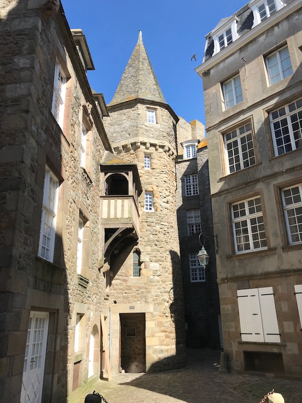
The house called 'La Houssaye' with its turret and cut stone architecture were mentioned in the oldest accounts of the town from the late 15th century.