Our Blog - Domme, France
We had never heard of the town of Domme before, but the owner of the Chambre d'Hotes (a B&B) that we stayed at the night before the Strawberry Festival mentioned it to us. When we got through everything for the Strawberry Festival a bit early, we decided to add it to our itinerary. As we are zipping through the countryside, we see these large satellite dishes that he also had mentioned. It is a "secret" military installation, supposedly one of the largest listening centers in the world with 13 huge dishes.

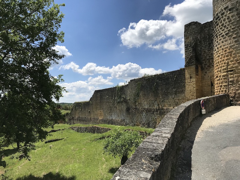
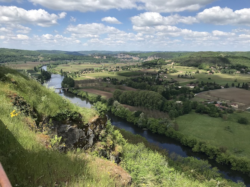
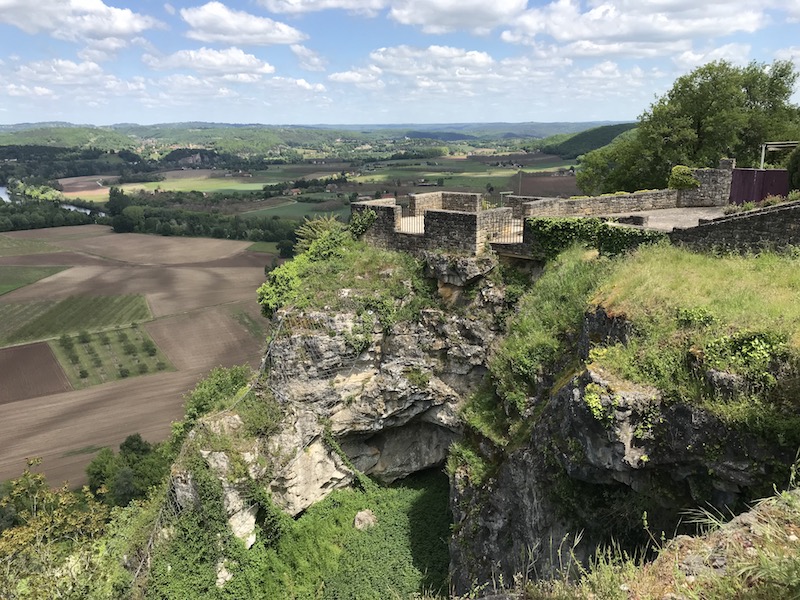
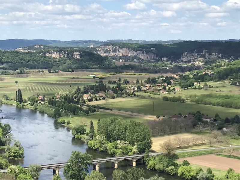
The village of Domme is another fortified towns (bastides) which is listed as one of the Most Beautiful villages in France (Les Plus Beaux Villages de France). It is perched on a cliff 850 feet above sea level overlooking the Dordogne River. Around 1281, King Philip III, also known as Philip the Bold, created a country house here with the Bastide to protect him. While most bastides have a rectangular plan, this one does not since the fortifications had to adapt to the shape of the clifftop that it was on. Inside the bastide, it was more normal, with intersecting streets, squares, and a town hall. The bastide was taken over several times by the English during the 100 Years War, and also changed hands between Protestant and Catholics during the Wars of Religion.
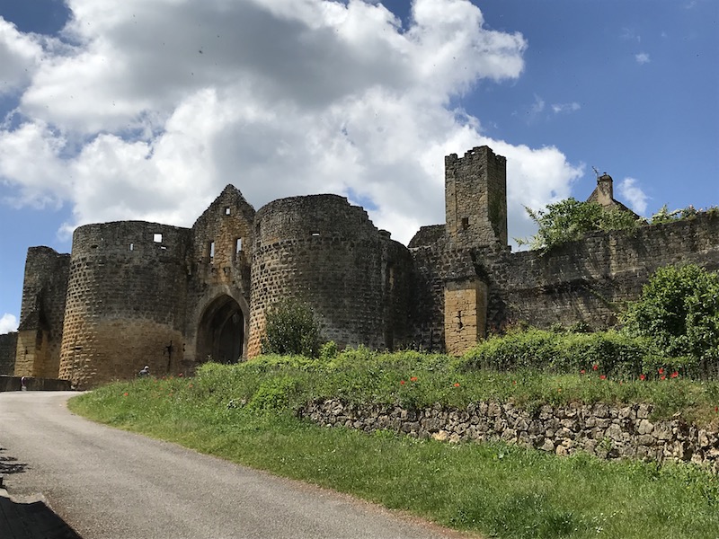
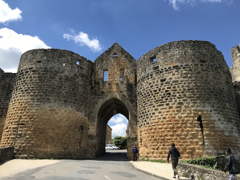
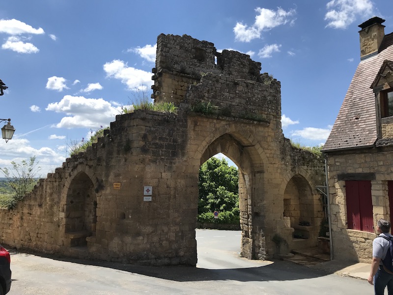
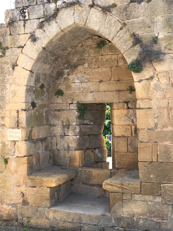
The Porte des Tours (Doorway of Towers), is one of the main access point into the city but was also the one that was the most exposed, facing the countryside. You can see what would have been the walls of the moat on either side of the gateway. It was also used as a prison where some of the Knights Templar were kept. Supposedly, there is graffiti in the tower that came from the Templars, but some scholars have debunked that claim. We didn't bother going through the tower.
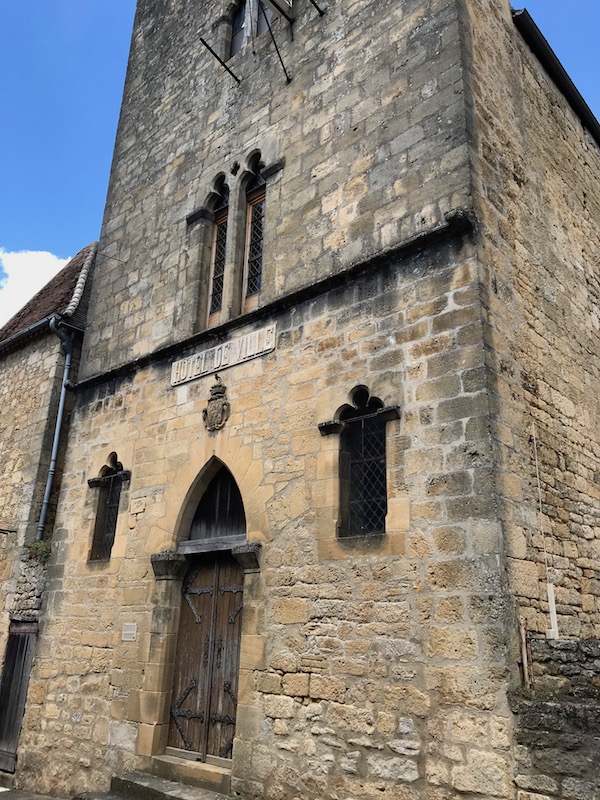
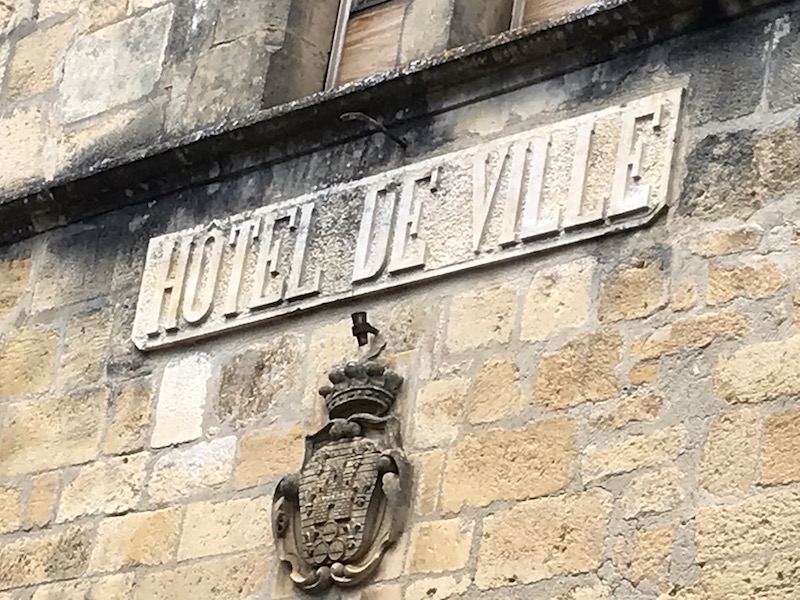
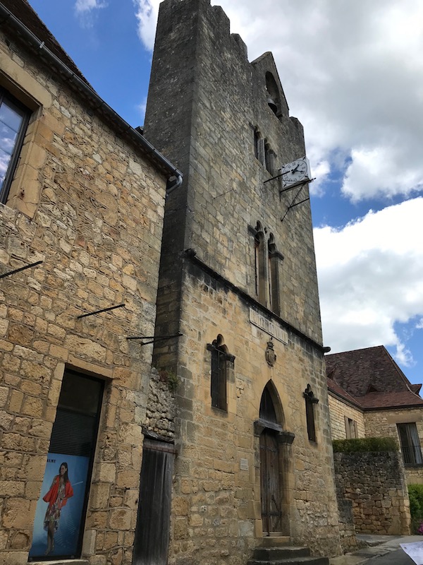
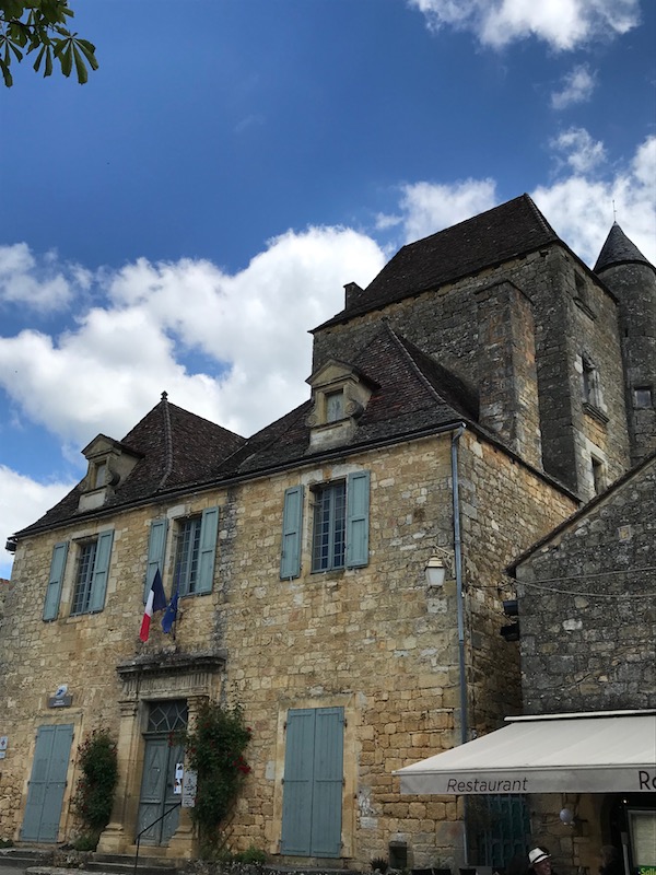
Today, the original Hotel de Ville is used for marriage ceremonies, but it is an example of late 13th century architecture. It has a tall façade which has a bell, which is a bit odd (normally bells only in the churches). The town's coat of arms that is seen was added in the 17th century.
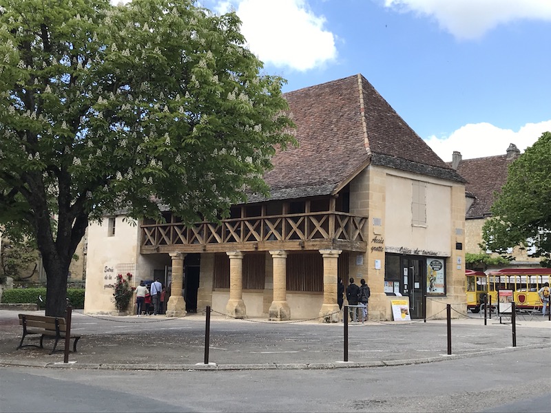
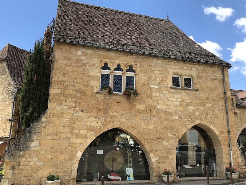
Like with many towns, the market hall was the center of life in the 17th century. This hall is unique in that it has 2 floors with a wooden gallery. There is also a grotte (cave) under the city and the entrance to this cave is under the market hall. The huge caves exist under the entire town and you can go down into the caves and see stalactite and stalagmite formations. They are the biggest caves in the Perigord Noir area.
This house dates all the way back to 1454, when it was the home of the governor. The rectangular tower also has a small round tower on the side.
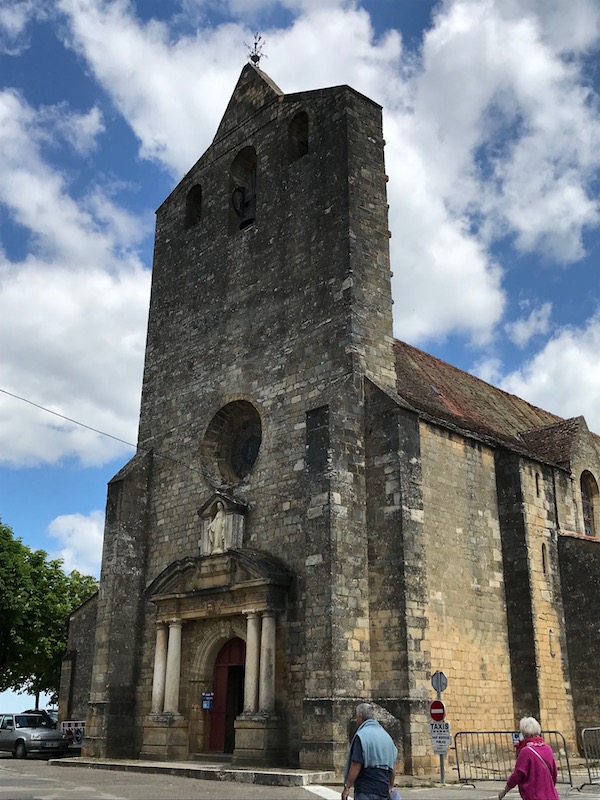
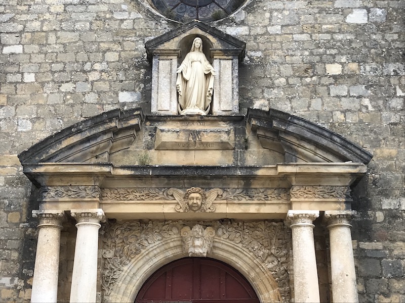
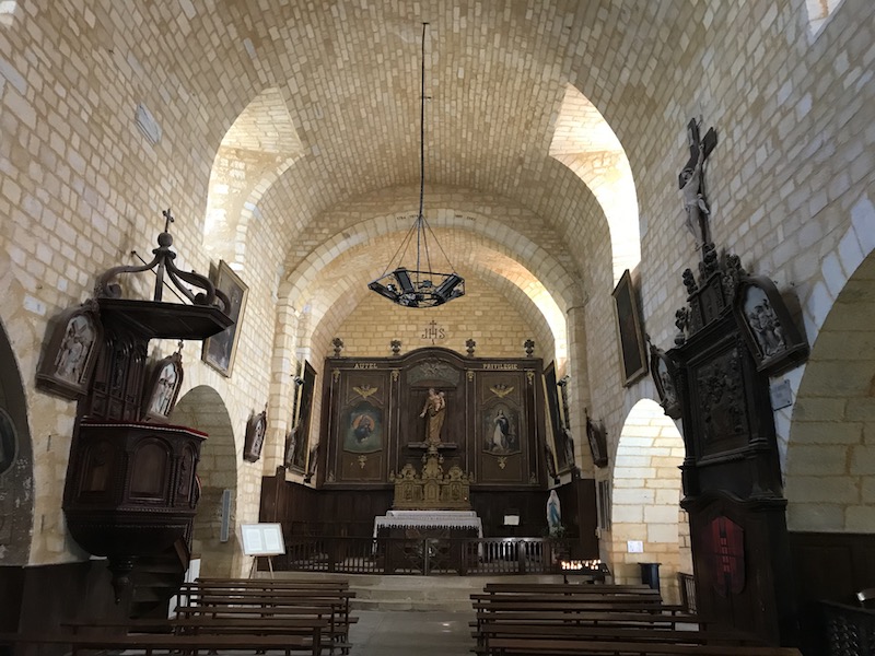
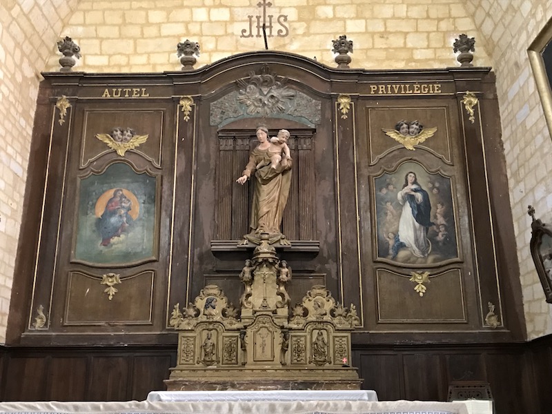
The town church building dates back to 1622 (after being rebuilt after the previous church building was destroyed in 1589). It has a single name with a bell wall (just a wall, not an actual tower). The weather vane at the top was installed in 1790 and the entrance doorway dates back to 1883.
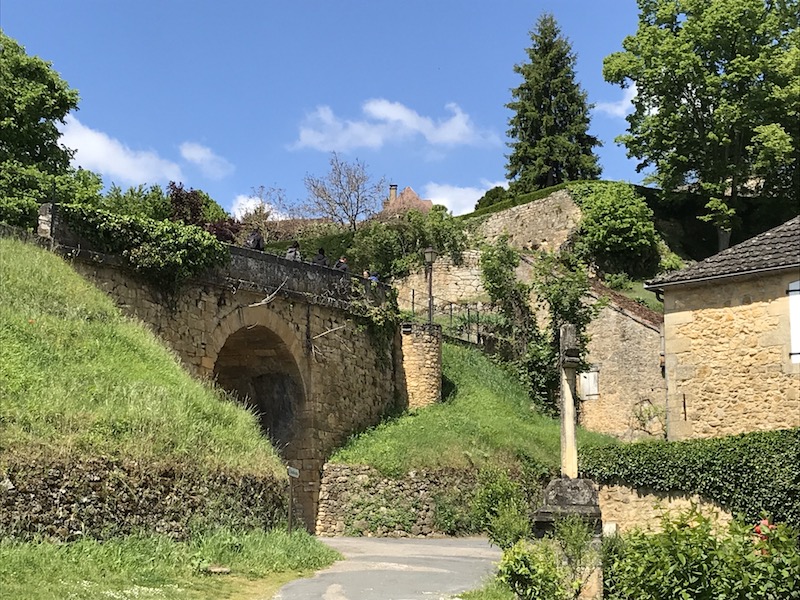
I mentioned it was built on a cliff over the Dordogne River, and from a public park, you can get some great views of the river and countryside down below.
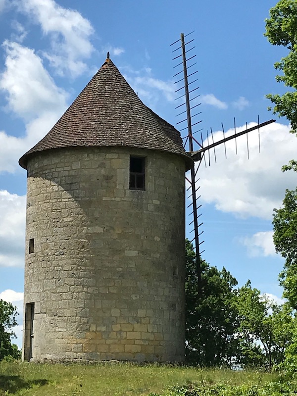
From the 12th century, the control of wind was important, especially for these cliff-top towns. In the case of Domme, an old windmill still is visible in the public gardens.
Domme was given the privilege to mint their own coins by Philippe the Bold, and this was the original building where the minted the local coins.
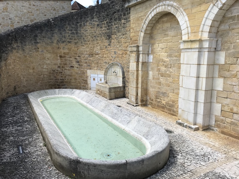
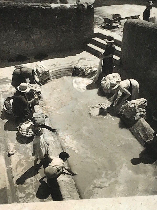
There is a public wash house, which was built in the early 20th century to wash laundry in. It was covered after World War II so that it could be used even when it was raining. Interestingly enough, it was still used up until the 1970's. It was immortalized in 1937 by a famous photographer, Robert Doisneau. The first picture is the actual wash basin now, and then I have the 1937 picture.
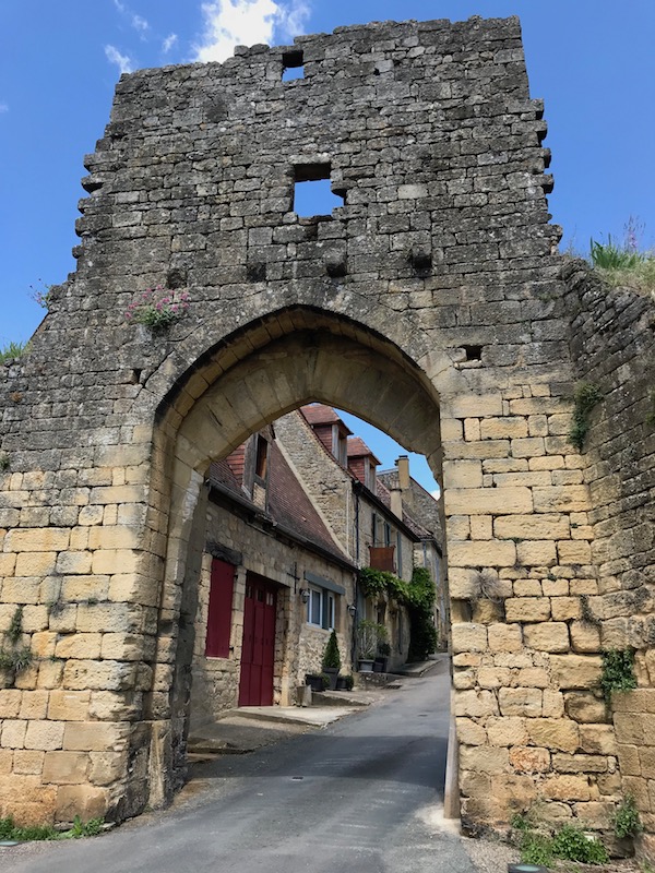
Another gate, this time the Del bos Gate, or Gate of Wood. Built in the 13th century, it was modified in 1912 to allow larger cars and trucks to go through. There is a 2-story tower that contains slits to shoot arrows out of. Needless to say, the gate is no longer made of wood.
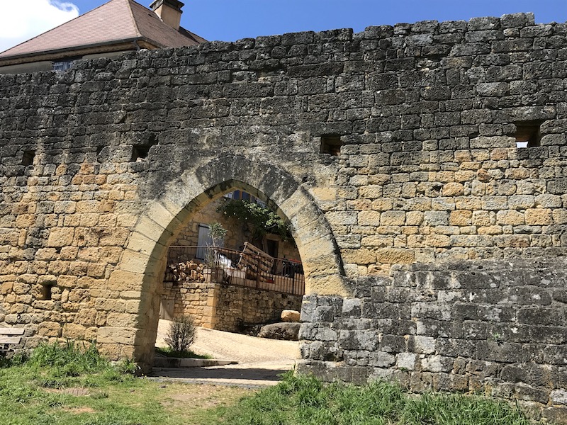
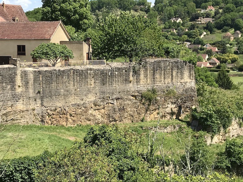
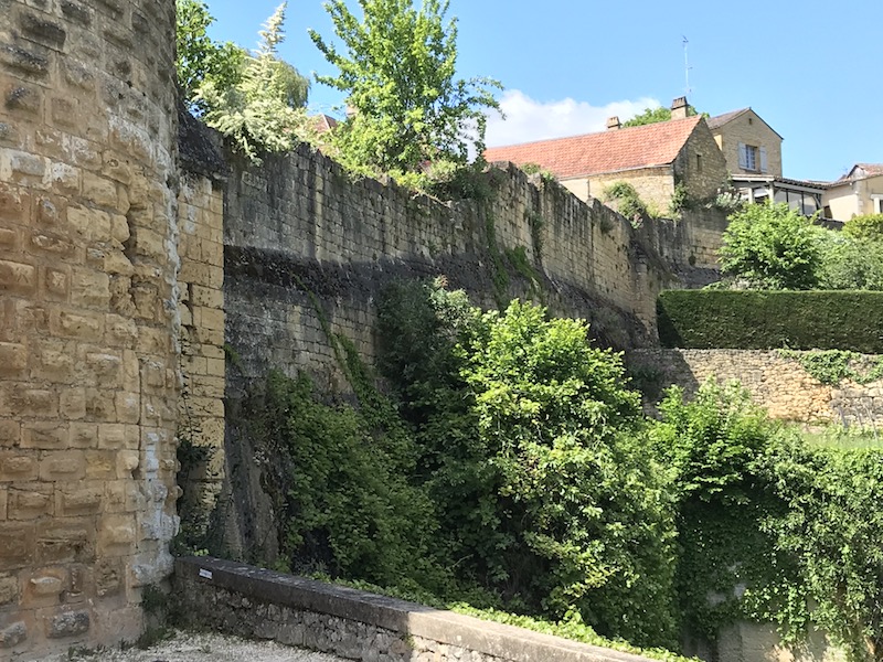
You can somewhat see the city walls here. The fortifications (the ramparts) were built between 1281 and 1310, but they do not go all the way around the city. Due to the sheer rock face on the North side, the defensive walls didn't need to continue on that side. Or at least, that was the thought at the time. Unfortunately, in practice, that was not specifically true since the city was taken in 1588 by the Huguenot captain, Geoffrey de Vivans during the Wars of Religion by scaling this rock face.
The Combe Gate is the last of the gates, and this provided access to several water sources just on the outside of the walled town.