Our Blog - London, UK - Day 1
On our way to pick up the London Walks tour, we popped into a church called Saint Giles in the Fields. The church was named for St Giles the Hermit, and it began as the chapel of a 12th-century monastery and leper hospital in the fields between Westminster and the City of London. The present church is the 3rd on the site since 1101 and was rebuilt most recently in 1731–1733 in Palladian style. Both from the outside and the inside, it really reminded us of a couple of the churches that we saw recently in Boston and Philadelphia. There is an interesting story on why it was rebuilt in 1731. The St Giles parish was heavily hit by the plague. By the end of 1666, over 1,000 parishioners had been deposited into a plague pit in the churchyard. So many bodies were buried there, in fact, that the level of the churchyard was as much as 8 feet above the floor of the nave inside the church. This was causing dampness inside the church, and so a new church was built. The gate is called the Resurrection Gate, and was created in the late 1600's (before the new church was built) and rebuilt in 1810. It was then taken down in 1865, as it had become unsafe, and re-erected on the West side in anticipation of a rerouting of Charing Cross Road. The bas-relief on the gate shows Judgement Day.


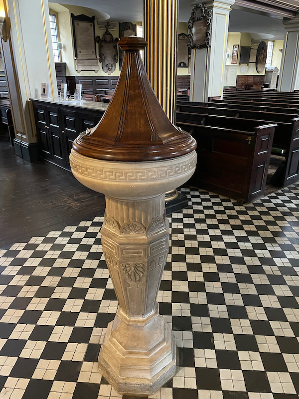
Just inside the door is the white marble Baptismal Font with Greek Revival detailing, which dates from 1810.
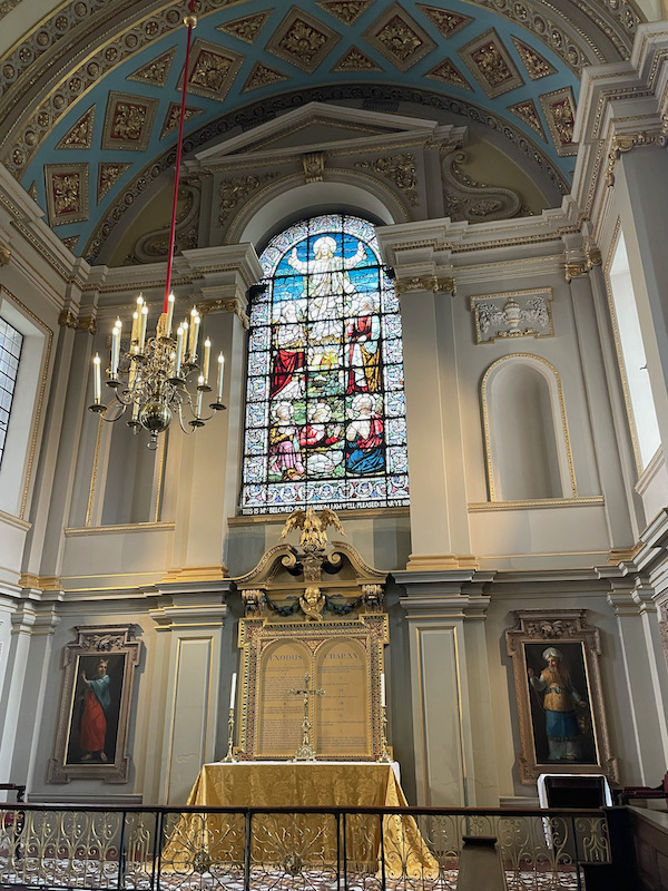
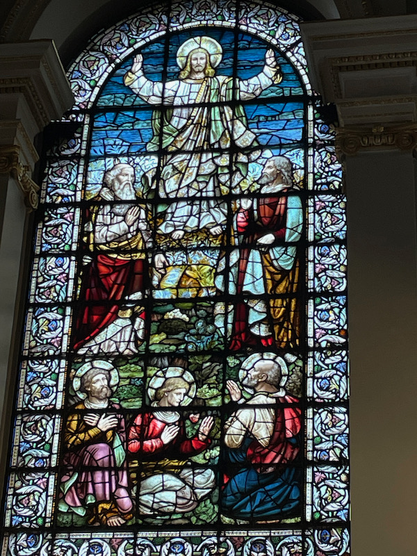
It is a very rectangular interior on 2 floors. The stained glass window at the east end of the church depicts the transfiguration of Christ on mount Tabor.

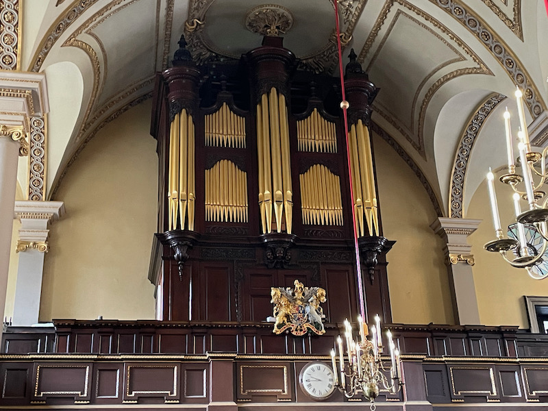
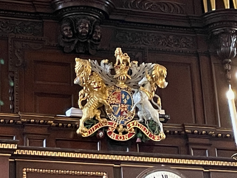
The organ, which was been rebuilt multiple times, has a nice wooden cabinet with a Coat of Arms (although I can't find any information on what the Coat of Arms is for).
Lunch was fish and chips (of course!) at a place between our hotel and the start of the walking tour, called Ben's.

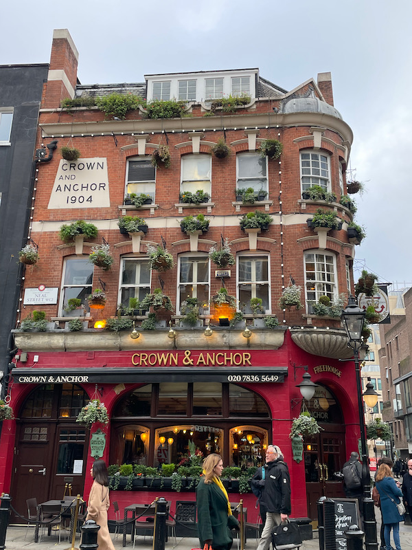
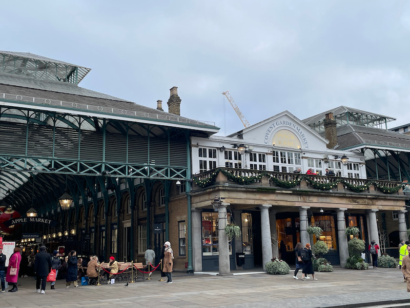
I always think London is a wonderful mix of old and new buildings. This one, the Crown and Anchor pub, dates from 1904. Then we walked past the Covent Garden Market (which reopened in 1980)
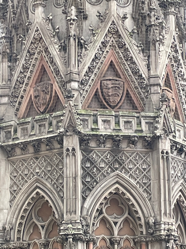
Then we came across this thing at the Charing Cross railway station. I initially said "Oh, this must be the "Charing Cross" that the station takes its name from. I was only 1/2 right! The area and station gets the name from the lost hamlet of "Charing" and this monument, the Eleanor Cross. King Edward I had a series of 12 stone monuments erected in a line down part of England in memory of his wife, Eleanor of Castile. The crosses were placed in the places where her body rested on the route taken from where she died in the East Midlands (in 1290) to Westminster Abbey. The hamlet of Charing was the final night of the journey. This one is actually a replica that was built in 1865 (the original was taken down by Parliament in 1643 and demolished).


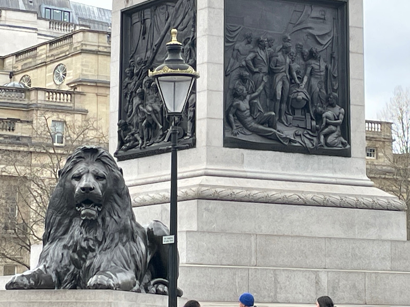
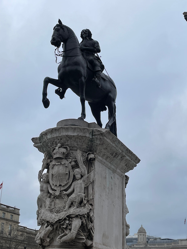
Then past Trafalgar Square, with 4 large lions at the bottom of the Nelson Column, in front of the National Gallery building. In the middle of the roundabout is an equestrian statue of Charles I. It is actually at the exact location of the original "Charing" Eleanor Cross that was erected by Edward I and then taken down in 1647. This statue defines the center of London and all road sign distances to London are measured from this point.


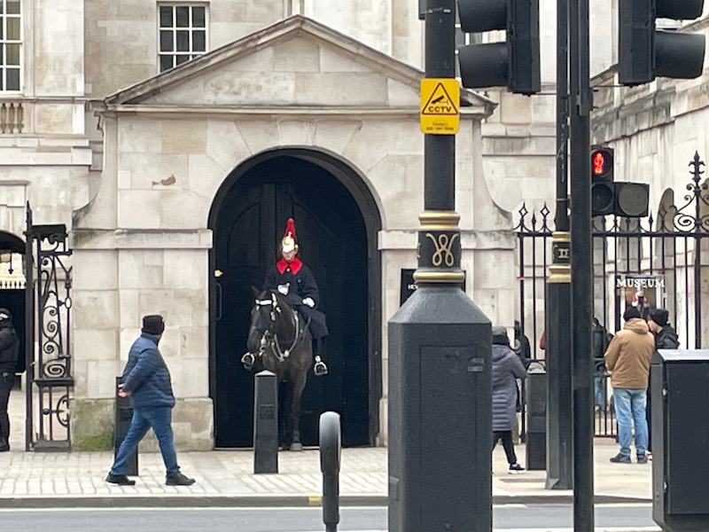
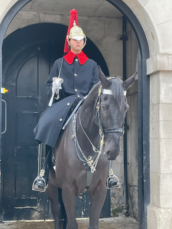
This is something I don't know if I remember from London .. the Horse Guards Parade. The building has a clock tower over an archway, and remains the official entrance to St James's and Buckingham Palace. Horse Guards dates from the 18th century and was designed by the Chief Architect to George II. The building is guarded by two mounted cavalry troopers of The King's Life Guard who are posted outside and there is a Changing of the Guards ceremony that takes place every day, and you can see people lined up to see the start of it if you go by at the right time. In the first picture, the horse with rider is inside the small rounded opening bottom-right.

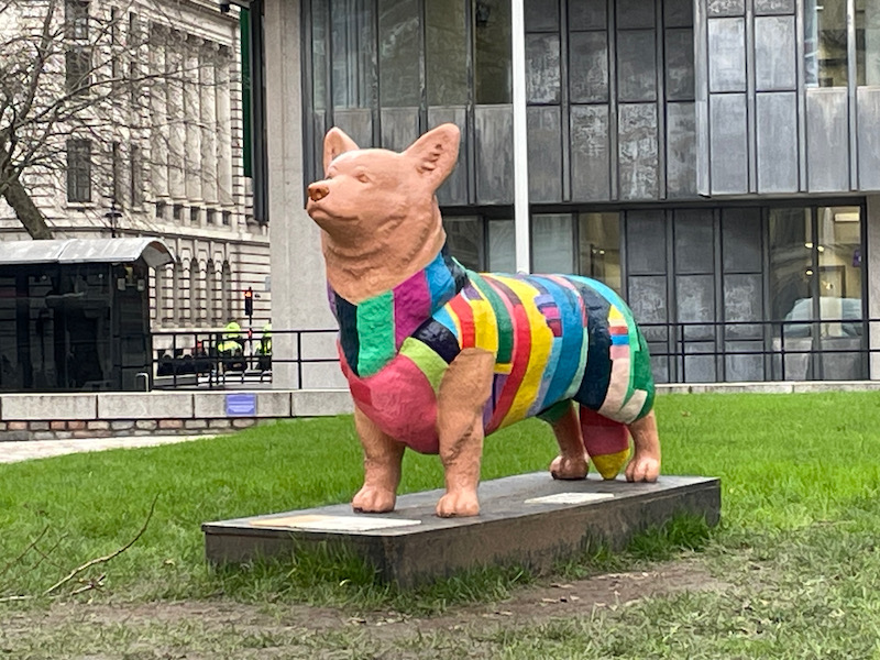
As we arrived at the start of our Westminster neighborhood walking tour, we came across literally THE ONLY corgi that we saw in 3 days in London!!! Where are all of the Corgis??? Well ... in fact, to celebrate her Platinum Jubilee, a set of 19 corgi sculptures by contemporary artists were created and placed around London (there was a map to show the Corgi Trail), named after some of the Queen's beloved corgi dogs. This one (I think) is named "Jane", who was one of the first royal corgis (acquired in 1933). The artwork is in the garden of the QEII Center.
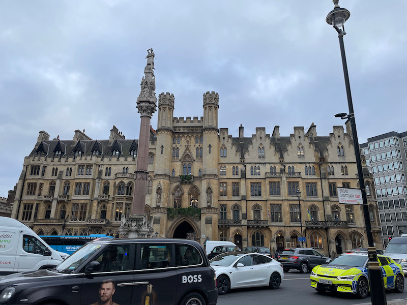
As we waited for the start of the tour, we took a look at The Sanctuary, which looks like a Medieval castle with the little towers, and the Westminster Scholars War Memorial in front of it. At the top is St George slaying the dragon, and then 4 Gothic niches housing statues of St Edward the Confessor (facing east), Henry III (west), Elizabeth I (south), and Queen Victoria (north). More on the Sanctuary in Day 3.

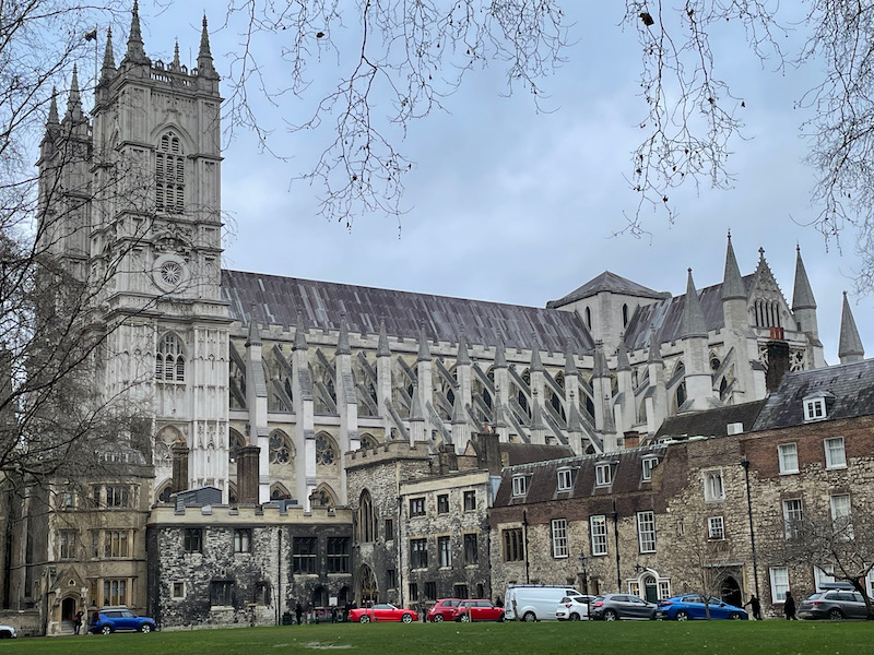
We started the tour by going through the arch in the middle of the building and into Dean's Yard. This little oasis next door to Westminster Abbey has a lawn in the middle (called Green) and is surrounded by buildings that mostly house the Westminster School, which is a public school that has existed since the 14th century. You can see the green lawn there, with the buildings and then the roof and towers of Westminster Abbey. The video attempts to take you around the entire square.
You will notice that I didn't take very many pictures during the tour, just a few to get an idea of the neighborhood. The "City of Westminster" is one of the borough's of London and it contains a good deal of the British government offices, as well as the well-known districts of Covent Garden, Hyde Park, the West End, and Soho. It became an official city in 1540, although in the mid-11th century, King Edward the Confessor began the construction of an abbey (only the foundations of which survive today). We walked around a bunch of small streets with houses that are great examples of Georgian architecture.

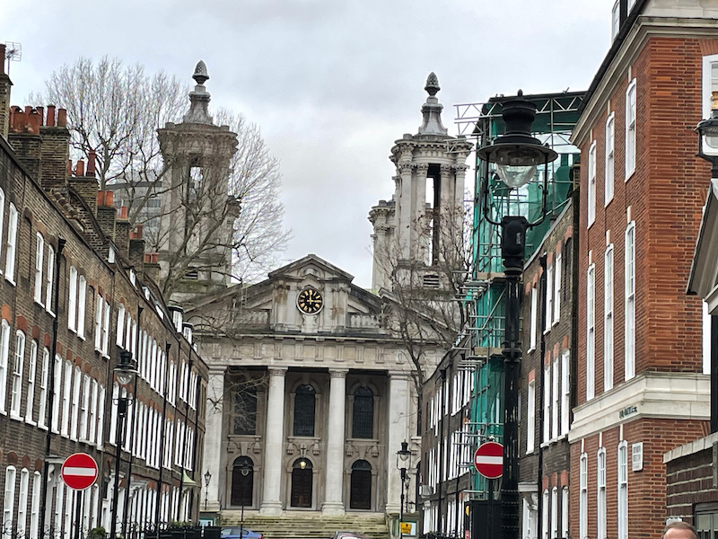
Saint John's church was built in 1728 and dedicated to St John the Evangelist. It is nicknamed "Queen Anne's Footstool" because there was a legend that said when Queen Anne was asked about the designs for the church, she kicked over her footstool and said to make it look "like that", pointing to her upturned legs of the footstool. However, the towers were actually added to stabilize the building (although it does look like 4 legs pointing up). It was heavily damaged during WWII and remained without a roof (and in ruins) for 20 years. It was finally renovated as a concert hall.

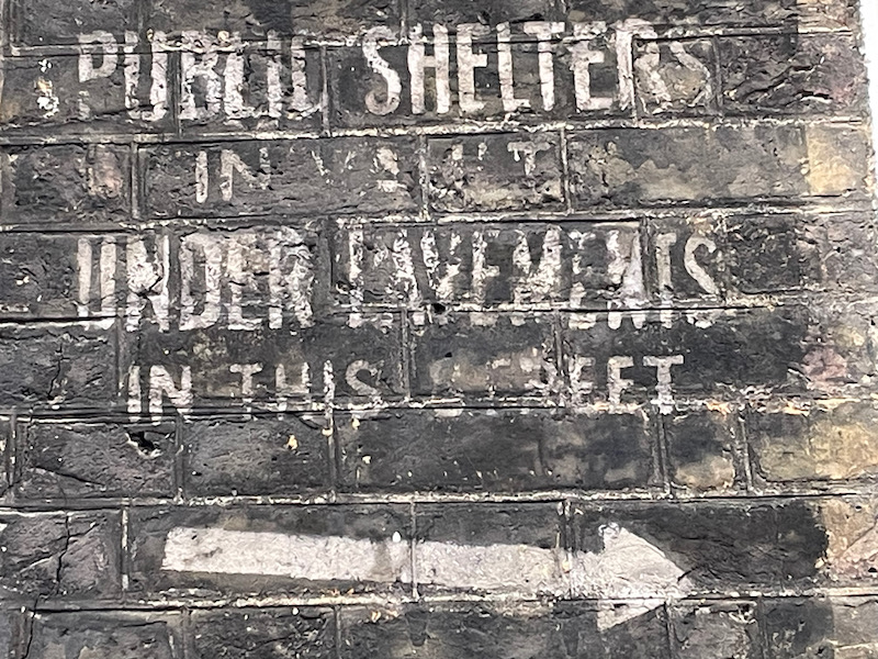
This was quite interesting to me ... just walking down a road with nice houses ... one the wall is a painted sign on the brick that says "PUBLIC SHELTERS IN VAULTS UNDER PAVEMENTS IN THIS STREET" (next to the door on the left, the white arrow is the most visible part). Various bloggers have mentioned this "ghost signs" that date back to the air raids during the Blitz in WW2. These signs would have directed local residents to safe spaces underground. When the air raid sirens would go off, people would seek safety here, or in other places like the London Underground stations (some of which are very deep). They are painted white (on black) so that they could be seen at night, when the city was under blackout regulations and there were no lights.

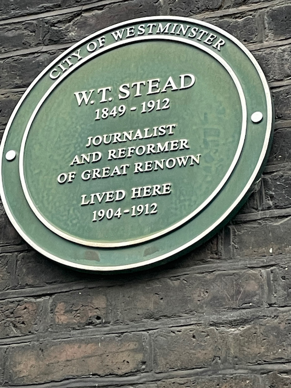
As we walked around, we saw quite a few plaques that spoke of various famous people who lived in various houses here.
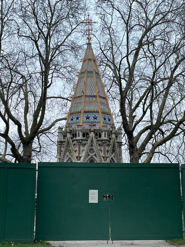
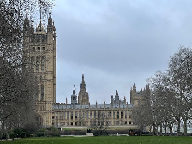
While you can't see it that great, we ended the tour in the Victoria Tower Gardens, at the Buxton Memorial Fountain. It commemorates the emancipation of slaves in the British Empire in 1834 and was commissioned in 1865, coinciding with the passing of the 13th Amendment in the US that ended slavery. The park sits in the shadow of the Victoria Tower (hence the name), which is at the SW end of the Palace of Westminster.

A pretty full day! It was January, so by the time we finished the tour, it was getting fairly dark. We headed back to our hotel and the pub on the ground floor for a drink before dinner.